Hafa Adai and Tirow! Welcome to the Division of Environmental Quality - Bureau of Environmental and Coastal Quality website.
Water Quality Surveillance & Non-Point Source Branch
The Water Quality Surveillance and Non-Point Source (WQS/NPS) Program was established in response to EPA's growing water quality program requirements; to monitor, and when necessary, remediate both our marine waters and our fresh water systems such as streams, lakes and wetlands.
Non-point Source Pollution (NPS) in the CNMI generally affects the health of our watersheds. NPS is a concern worsened by heavy rainfall and man-made pollutants carried to coastal areas by runoff that has a direct impact on the surrounding beaches and marine life. The most common sources of enterococci contamination from Non-point sources in the CNMI include: sediment-laden storm water runoff with naturally occurring enterococci from urban runoff, erosion from construction sites, illicit wastewater discharges from animal pens and outhouses waste from free-range feral and domestic livestock, and lack of adequate public restroom facilities at frequently visited tourist sites. Addressing non-point source pollution is a very important step in protecting our watersheds from impairment.
The WQS/NPS Program is funded by the US Environmental Protection Agency through the Clean Water Act. This funding is used to monitor and evaluate the health of our marine waters and fresh water streams, lakes and wetlands through regular sampling and analysis, and ground-truthed assessments. Those waters that fail to meet the CNMI water quality microbial standards are "red flagged" in public Beach Advisories. Waters that are frequently "red flagged" or fail to meet other water quality standards like, nutrients, dissolved oxygen, turbidity etc., are considered impaired. They are then included in the 303(d) impaired waters list as required by the Clean Water Act.
Impaired waters are further studied by the WQS/NPS "Stream Dream Team", a committed group of individuals that together conduct watershed sanitary survey assessments, map streams using GPS and ArcGIS, and test water quality to identify and map the source of pollutants. Assessment findings are shared in the biennial 305(b) and 303(d) Water Quality Assessment Integrated Report. Findings are also used to create Integrated Watershed Management Plans (IWMPs) to:
- address the sources of pollution using Best Management Practices;
- engage and inform individuals living within the watershed of the cause and source of pollution, and ask for their collaboration to prevent further detriment;
- and to restore CNMI waters so they are once again "swimmable and fishable" for the enjoyment of our visitors and our community.
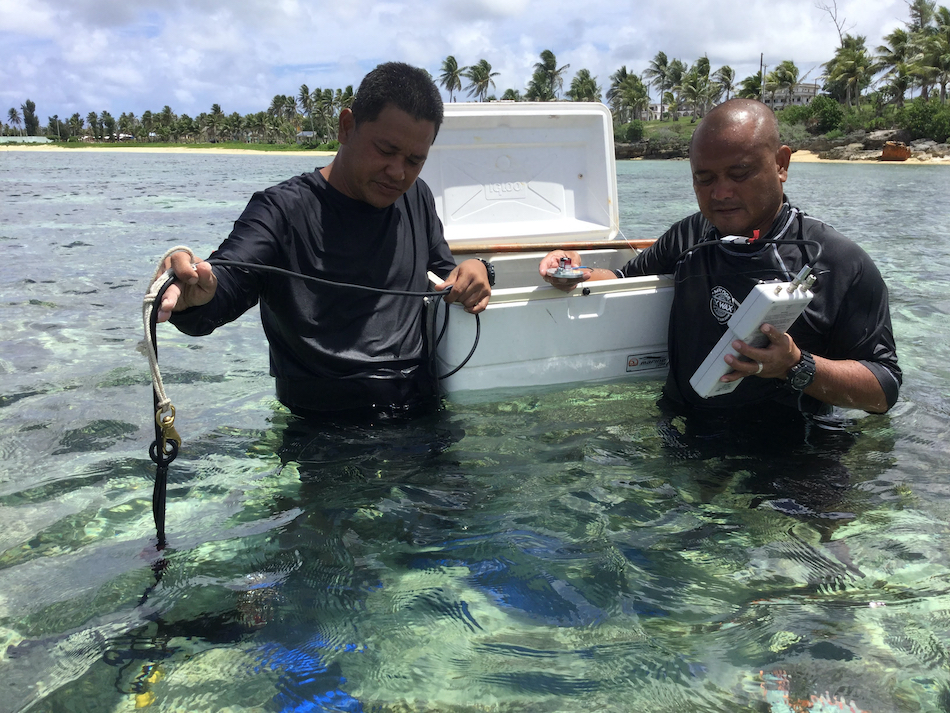
Conducting water quality assessments on Tinian's reef flat
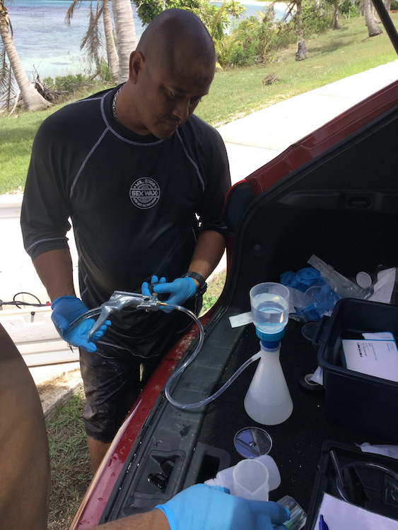
Filtering nutrient samples for transport to DEQ Laboratory
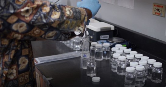
Preparing samples for microbial testing using the 24 Hr Enterolert Method
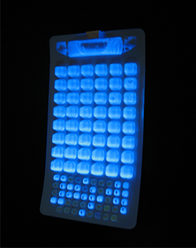
Fluorescence indicates the Presence of Enterococci
Marine water samples are collected weekly by WQS/NPS staff and tested by DEQ's Environmental Surveillance Laboratory to monitor the chemical, physical, and microbial quality of our near shore waters that surround our most popular and frequented beaches. This includes the islands of Saipan, Tinian, Rota, and Managaha.
The microbial fecal indicator bacteria, Enterococci, are used to assess the presence of human or animal waste. Enterococci levels that exceed the CNMI Water Quality Standards may indicate that there is a health risk associated with recreating in marine waters at these sites. These sites are then "red flagged" in a Public Beach Advisory.
Additional water samples are taken upon reef flats surrounding these islands and in Saipan's lagoon by WQS/NPS and DCRM's Marine Monitoring Team (MMT). BECQ also conducts biological assessments of the reef and benthic habitat at these sites. This biological data combined with Water Quality Data, and other studies conducted by federal and local partners, are used to make a comprehensive assessment of the health of CNMI marine waters. Findings are provided to US EPA, Congress, and the general public in the biennial CNMI 305(b) and 303(d) Water Quality Assessment Integrated Report.
All waters bodies assessed as not attaining their Designated Uses ("fishable and swimmable") are put on the US EPA 303(d) list of impaired waters. Impaired waters are then required to have a Total Maximum Daily Load (TMDL) set in order for natural resource managers to work towards their restoration. The TMDL identifies the maximum amount of a pollutant that a body of water can receive while still meeting water quality standards. The impaired water bodies on Saipan have a TMDL set for bacteriological contamination, as of December 2017. Each of these impaired water bodies also have a "Report Card" for providing policy makers and managers direction in restoration efforts.
Beach Advisories
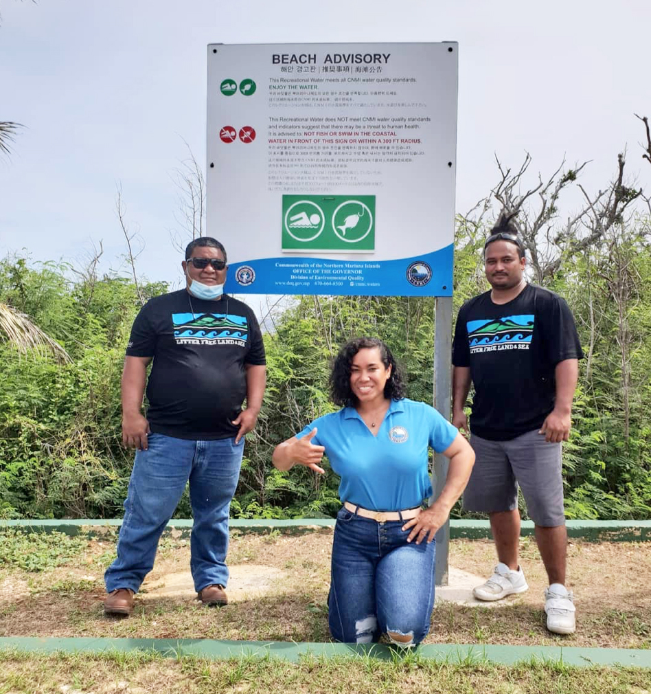
Beach Advisory Sign at Grotto, Saipan
Should the water quality results from a beach site or other monitored stream site exceed the CNMI Water Quality Microbial Standards, a Public Beach Advisory, or "red flag" is posted in social media, such as it is here on the DEQ website, and on the CNMI Waters Facebook page.
It is also emailed to various agencies and individuals who ask to be on the email list, and faxed to local papers for publication. Please send an email to to be added to the list.
Red and Green Flag placards are also posted on beach signs located at some of Saipan's most frequented beaches.
If a "red flag" occurs in an area that is highly used, like in front of hotels, WQS/NPS staff will go to the beach that same day to resample the beach. This allows BECQ to notify the public as soon as possible when potential pathogens are no longer present and it is once again safe to recreate in these waters.
Many of the selected beach sites have been monitored continuously since the late 1980's. That is why some beach sites bear the name of an old hotel that has since been renamed under new ownership. The original site names are used to ensure that these sites remain associated with historical data kept within the BECQ database and in the US EPA databases, and US EPA BEACON website.
Stream Water Monitoring & Watershed Assessment
Ridge to Reef
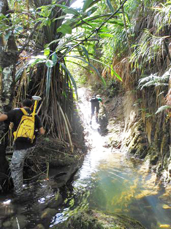
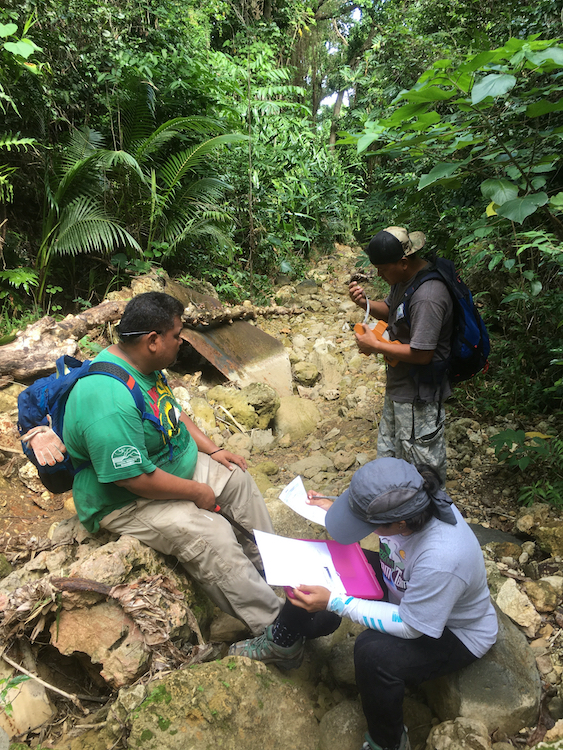
The WQS/NPS staff are members of the Stream Dream Team. The Team is responsible for monitoring and assessing impaired streams that have been designated in the 303(d) impaired waters list.
As most of the streams in the CNMI flow ephemerally, and this requires rapid response by the Team to quickly collect stream samples from the upper, mid, and lower watershed while there is still flow, which means hiking to sampling points during down pours and other storm events. BECQ developed the CNMI Stream Visual Assessment Protocol (SVAP) to assess stream water quality when water samples cannot be collected.
The SVAP help do document pollution sources within the watershed (e.g., roaming cows or pigs, illegal dump sites, illicit wastewater discharge, etc.) and types of pollution encountered (wastewater, heavy metals, nutrients, etc.).
Surveys have been completed in the Laolao and Achugao watersheds, as well as partial surveys in the Talofofo and Takpochao watersheds. The SVAP characterizes the watersheds' condition and how they are impaired from "ridge to reef".
The Team's assessment findings are also used to create Integrated Watershed Management Plans (IWMPs) that resource managers can use to tackle the sources of pollution and to restore the watershed's "health" . These restoration projects are not possible without the help and involvement of the village community surrounding the streams.
The Team continues to partner with local and federal agencies, especially the Natural Resource Conservation Service (NRCS), to help farmers learn about and adopt environmental Best Management Practices (BMP) to improve sanitary conditions at home and in the watershed.
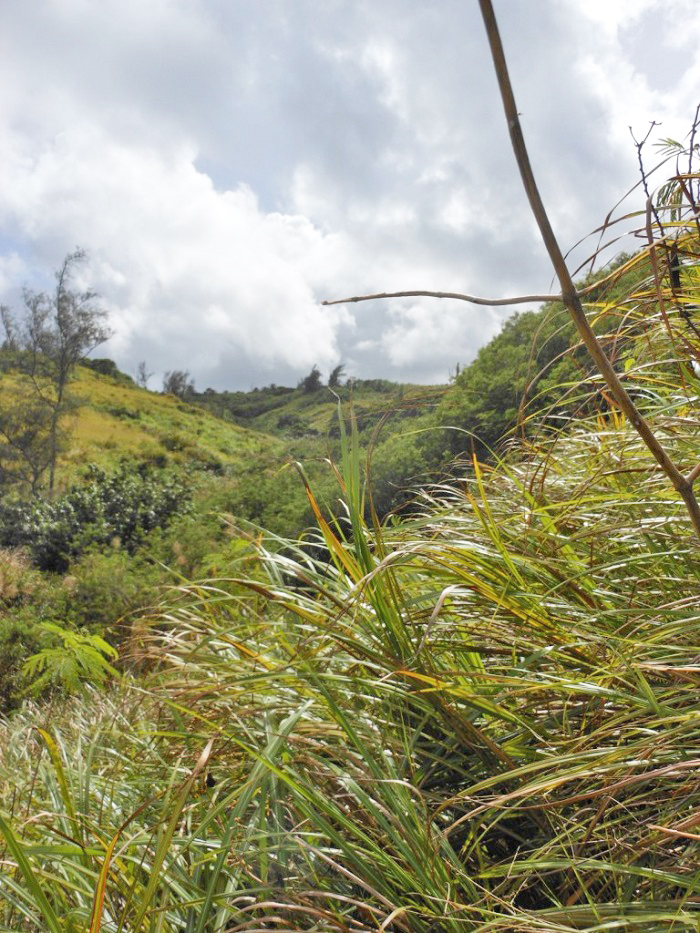
Achugao Watershed Ridge
Lower Watershed: Greywater Discharge to Stream
Upper Watershed: Achugao Stream Near Ridge
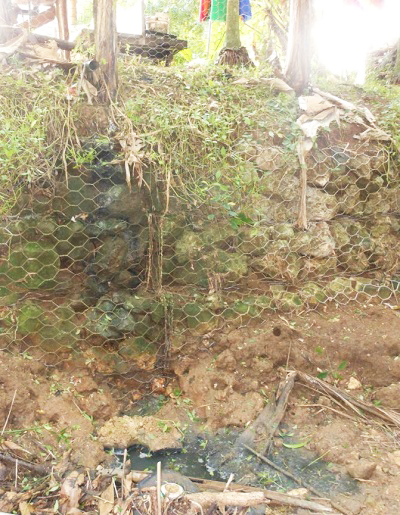
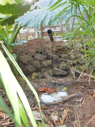
Lower Watershed: Piggery Waste Discharge to Stream
Mid-Watershed: Above Residences
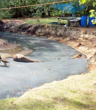
Stream Outlet to Tanapag Lagoon: "fish kill" Dec 2013
Restoration of Impaired Waters
CUC assists low income families to hook-up to sewer instead of using septic tanks that need pump-outs
NRCS talks with homeowner about grants for building sanitary dry litter piggery
LIHEAP assists with utility fees to offset cost of sewer line fees
NMHC talks about grants and loans to build roofs, waste systems, and plumb kitchens up to code
DPW helps low income families switch old appliances for new energy efficient ones
The Stream Dream Team works with communities living within impaired watersheds to restore stream systems and to prevent further pollution from contaminating the surrounding marine ecosystem.
The Achugao Watershed, which envelops the San Roque and Tanapag villages, contains three stream systems that were impaired, the Achugao, Dogas and Agatan streams.
Stream Visual Assessments were completed in 2020, which revealed many illicit discharges of kitchen greywater, waste from animal pens, and failing sewer lines and connections.
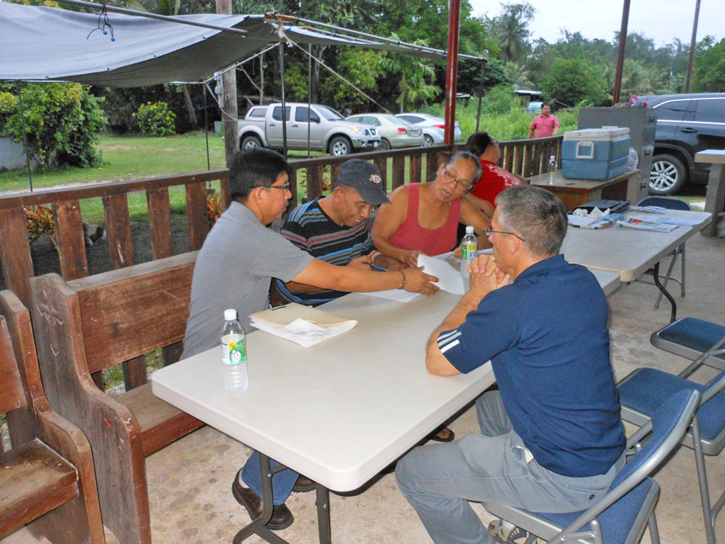
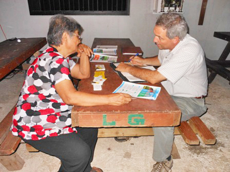
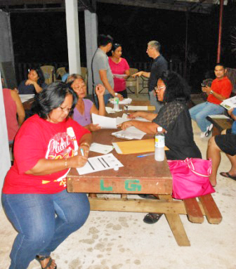
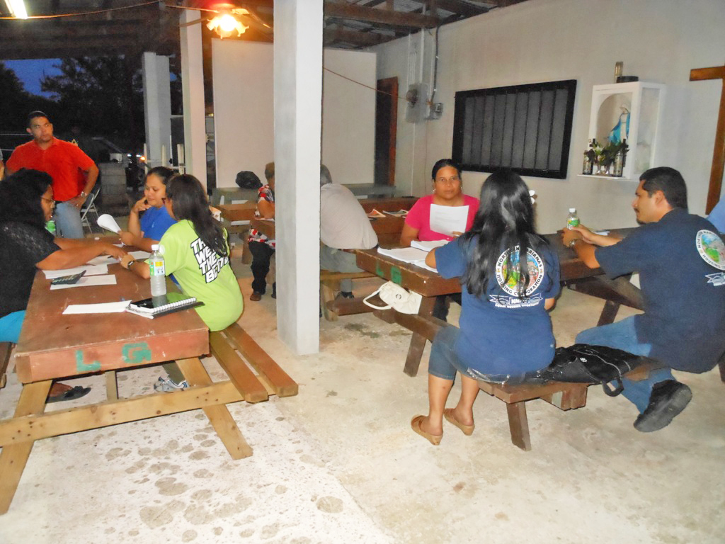
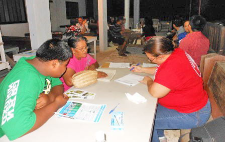
The Team visited families to learn more about their environmental awareness, and their financial ability to address non-point sources of pollution.
The Forum was designed to bring the agencies to the homeowners, many low income, rather than having homeowners find transportation to the agencies, which would require them to leave work (and much needed income) to apply for assistance to clean up their watershed.
In so doing, villagers could easily apply for financial aid from various local and federal government programs.
This included the Commonwealth Utility Corp (CUC) for sewer hook up with funding from US EPA, Department of Public Works Energy Division (DPW) for replacing appliances with energy efficient ones, Department of Community and Cultural Affairs for Low Income Housing Energy Assistance (LIHEAP), Natural Resource Conservation Service (NRCS) Environmental Quality Incentive Program (EQIP) to design and construct sanitary animal pens, and the Northern Mariana Housing Corp. Home Program (NMHC) to upgrade home infrastructure.
This year long effort resulted in all animal pens being removed completely or setback from the streams in compliance with CNMI Water Quality Standards, and sewer hook up of many homes previously on septic systems.
Many families were also awarded electrical subsidies, funding for home improvements, and the NRCS EQIP grant to at least two families to build dry litter piggeries.
These activities successfully resulted in the restoration of the Achugao watershed, which was shared with US EPA, USDA and congress in this Success Story to support future funding for other watersheds.

The story is posted on EPA’s website: Success Stories about Restoring Water Bodies Impaired by Nonpoint Source Pollution
(Direct link to the story): Achugao Watershed, Commonwealth of the Northern Marianas Islands: In-Depth )
REPORTS
CNMI 305(b) and 303(d) Water Quality Assessment Integrated Report
Every two years BECQ evaluates the health of CNMI Waters by analyzing water quality monitoring data, the biological health of coral reefs and seagrass beds, and interpreting the impacts of mapped pollution sources caused by natural events, development, and other human activities. Each CNMI water body is evaluated and the findings are discussed in detail in the biennial CNMI 305(b) and 303(d) Water Quality Assessment Integrated Report. Those waters that do not meet the "Fishable and Swimmable" use designations are designated as impaired in the 303(d) listing. The Clean Water Act (40 C.F.R. §130.7(b) (5)) requires that a Total Maximum Daily Load (TMDL) be calculated for impaired waterbodies as a part of restoration efforts. A TMDL is the maximum amount of a pollutant allowed to enter a waterbody such that the waterbody continues to meet water quality standards for that pollutant. A TMDL also determines pollutant reduction targets and allocates those reductions necessary to meet that target.
The WQS/NPS staff, or "Stream Dream Team" is tasked with identifying the causes and sources of impairment so Total Maximum Daily Loads (TMDL) may be established for addressing the identified pollutants. This may include the use of BMPs, engagement of, and action by, the watershed's community members, and other projects outlined in the watershed "Report Cards" and in community vetted Integrated Watershed Management Plans.
Read about your favorite watershed and beaches in the:
- 2022 Integrated Report-Response to Public Comments
- 2020 Integrated Report - 303 (d) List of Impaired Waters List and Delisted Waters - Response to Public Comments
- 2018 Integrated Report
- 2016 Integrated Report and Appendices
- 2014 Integrated Report
- 2012 Integrated Report
- 2010 Integrated Report
- 2008 Integrated Report
- 2006 Integrated Report
- 2004 Integrated Report
- 2002 Integrated Report
- 2000 Integrated Report
- 1998 Integrated Report
Reports
- 2022 Saipan Stream Sediments Report
- 2020 Saipan qPCR/Microbial Source Tracking Report
- 2017 Total Maximum Daily Load (TMDL) for Saipan's Coastal Waters
- 2017 TMDL Watershed Report Cards
Watershed Management Plans
- DCRM Watersheds Management
-
NFWF Wetland/Coral Nursery Restoration Monitoring Plan
Click Here to Learn More
In 2020, the Office of Planning and Development's (OPD) Natural Resources Taskforce members which included the Bureau of Environmental and Coastal Quality (BECQ) and the Department of Lands and Natural Resources (DLNR) worked together to secure close to $1.7 million in funding from the National Fish and Wildlife Foundation(NFWF) to implement priority projects aimed at building resilience through restoring select wetlands and coral reefs in the Garapan Watershed. The NFWF Coastal Resilience project builds interagency planning and project implementation capacity with a focus on flood risk reduction and habitat restoration. Project deliverables include tracking interagency engagement, water quality and habitat monitoring, invasive species removal, and enhancement of coral and wetland plant nurseries to support ongoing restoration efforts. The project is projected to outplant and monitor coral and wetland plants in Garapan, one of Saipan's priority watershed management areas, and is on track to continue through December 2024.
Saipan
- Garapan WMP 2020
- Garapan CAP 2013
- Achugao Interim Report 2020
- Laolao Bay Interim Report 2020
- Laolao Bay CAP 2012
Rota
Section 401 Water Quality Application Certification
- Section 401 Water Quality Certification Request Form
- 2022 American Memorial Park Repair/Replacement of Shoreline Structures WQC-2022-001
- 2022 LaoLao Bay Dive Path Markers WQC-2022-002
- 2022 National Park Service - American Memorial Park WQC-2022-001
- 2021 Garapan Fishing Base Revetment Section 401-2021-006
- 2021 Lady Carolina Vessel Removal WQC-2021-001
- 2021 Sea Touch LLC Saipan WQC-2021-005
- 2021 Route 36 (Windward/Chalan Kalabera) Road Improvements WQC-2021-002
- 2021 NPDES Pesticide General Permit WQC-2021-003
- 2020 NOAA Tide Buoys WQC-2020-001
- 2020 DCRM Coral Culture Facility WQC-2020-002
- 2020 Tinian Harbor In-Water Repair WQC-2020-004
- 2020 CPA Rota West Harbor - Small Boat Marina Repairs of Floating Dock WQC-2020-003
- 2020 Tinian Harbor Topside Repair WQC-2020-005
- 2019 Saipan Coral Nursery Pilot Project WQC-2019-006
- 2019 Saipan Coral Nursery Pilot Project WQC-2021-007
- 2017 Sadog Tasi Wastewater Treatment Plan ZOM-2017-001
- 2017 Agingan Wastewater Treatment Plan ZOM-2017-002
Notice of Violations/Advisories
Staff and Management
- Olivia Tenorio - Program Manager
- Joseph Ito - Environmental Specialist
- Shawn Masga - Environmental Specialist
- Michael Villagomez – NPS Environmental Specialist
- Jean Castro – Environmental Specialist